Ben Lui and Beinn a’Chlèibh: Useful Hiking Guide
Ben Lui and Beinn a’Chlèibh are regarded as one of the grandest and most elegant mountains in the Southern Highlands. The shortest way to the summit of Ben Lui is from Glen Lochy.
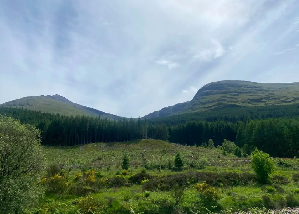
Ben Lui is also known as Beinn Laoigh. On approach from Glen Lochy, the peak of Ben Lui is on the left and Beinn a’Chlèibh on the right.
The water features a gradual climb through the gradual glen. Closer to the ascent of Ben Lui is a lovely basin-shaped corrie between Ben Lui and Beinn a’Chlèibh.
Ben Lui looks its best from Dalrigh, however, the ascent from this direction is difficult. Beinn a’Chlèibh just makes the Munro status and is often very much overlooked by Ben Lui and the other two Tyndrum Munros.
- Ben Lui: 1130 metres
- Beinn a’Chlèibh: 916 metres
- Distance: 10 kilometres (6.25 miles)
- Time: 5-7 hours
- Ascent: 1078 metres
- Starting Point: Glen Lochy Forestry Car Park
Where is this hike?
Ben Lui and Beinn a’Chlèibh are the two western Munros of the four Tyndrum Munros in Argyll. The two peaks are on the northwest border of the Loch Lomond and the Trossachs National Park.
The start point for this hike is on the A85 between Tyndrum and Lochawe. There is a small car park between Old Military Road and River Lochy called the Glen Lochy Forestry Car Park.
It is possible to hike Ben Lui and Beinn a’Chlèibh from Darigh (which is near Tyndrum). This route involves hiking the other two Tyndrum Munros – Ben Oss & Beinn Laoigh.
This route is extremely challenging and is a long day. For this route, it is best to start as early as possible and do it in the summer due to the long summer days.
Glen Lochy car park is a 1-hour 45-minute drive from Glasgow and Perth. From Edinburgh, the starting point is 2 hours and 15 minutes drive away.
Glen Lochy is over a 2-hour drive away from Dundee. Also, Inverness is almost a three-hour drive from the starting point.
How long is the hike?
The hike is 10 kilometres long. The first two kilometres take you through the forested glen, and at four kilometres the peak of Ben Lui is reached.
After reaching the peak, the next two kilometres descend and traverse west to the second peak – Beinn a’Chlèibh. The remaining four kilometres descend into the corrie and back through the forested Glen Lochy to the starting point.
The length of time it takes to complete the hike depends on the weather conditions and a person’s physical ability. As a rough guide, I complete the two Munros in 5 hours and 15 minutes.
Most people allow between 5 hours and 7 hours for the two Munros.
Are the paths marked?
For most of the route, the paths are not marked. From the car park to the railway line, there is a clear gravel path.
Then you have to cross under the railway which can be difficult depending on the weather conditions. Expect lots of water and wading at this point, it would be best to do this hike during a period of dry weather.
Once you have crossed under the railway and over the river, there is an eroded path which follows along a burn. Again, you have to cross over the water at some points, except to get wet.
The next stage of the walk is extremely boggy and marshy. It is a time-consuming walk as you will sink into the mud. Once you have walked through the forest and through the gate, there are very few marked paths to the summits of the Munros.
Is the trail suitable for beginners?
This is one of the most difficult Munros to complete and navigate. Also, it is not as popular as other routes.
Therefore, I would make sure you are prepared, have good navigational skills and get the weather before you go. There are other great Munros that are more popular, and easier to navigate.
This route is not as strenuous as many other Munros and minimal fitness is required. If you completed a few Munros, these two are physically good for you to complete.
How to get to the Munros?
The best way to get to these Munros is from the Glen Lochy Forestry car park which is located on the Old Military Road (A85). This is a small free car park and there are picnic benches.
There are a few lower-graded forestry walks which attract people to the car park especially in the summer and at the weekends.
The car park is a ten-minute drive from Tyndrum. There are a couple of train stations in Tyndrum.
Dalrigh is an alternative starting for the Tyndrum Munros, Tyndrum is a 25-minute walk from the Dalrigh. Ben Lui and Beinn a’Chlèibh is a long challenging walk from Dalrigh.
Route Description
This is a route description which begins from Glen Lochy Car Park for the two Munros – Ben Lui and Beinn a’Chlèibh.
Ascent
The beginning of this route begins at Glen Lochy Car Park which is located on the Old Military Road (A85). The gravel park leaves the car park at the south end and follows the River Lochy in the west direction.
The river is crossed by stepping stones and can be difficult to pass during periods of heavy rainfall. From there, the route goes under the railway bridge which is inaccessible during periods of high rainfall.
From the the route continues on an eroded path alongside the left side of the burn. Again, you have to cross the water at some point which is difficult during periods of rainfall.
The path continues to climb through a deforested area, and reaches a track. Cross this track and head back into a forested area.
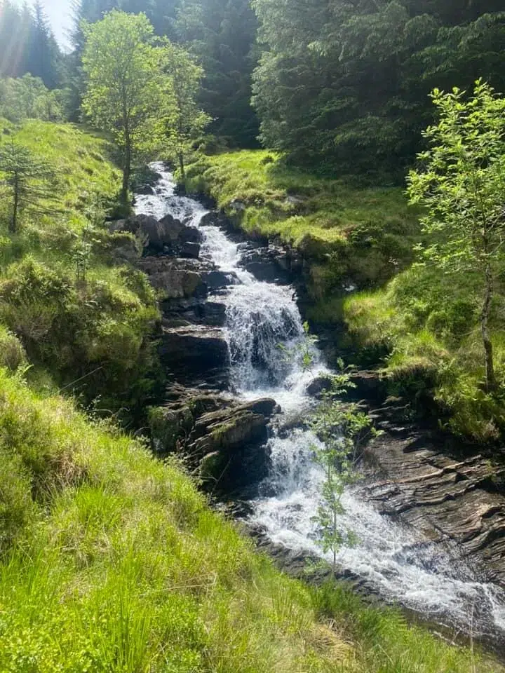
The path stays along the left side of the river. There are some pretty waterfalls in this section of the walk.
The underfoot is extremely boddy and wet in this section. If is difficult to get a step sometimes and you need to be really careful.
There is some wooden panels places in the mud to help you cross. Either way, be prepared to be knee deep in mud.
Soon you will reach a gate, go through the gate and gorgeous views will open up to the two magnificent Munros. The is a lovely corries nature reserve and it will take your breath away.
The rest of the route is mostly over a large grassland with mininal paths and guidance.

Near The Summit
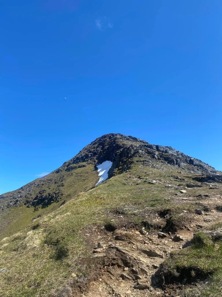
At 450 metres, turn left and start the steep ascent to the peak of Ben Lui. The summit becomes a narrow ridge at 1000 metres.
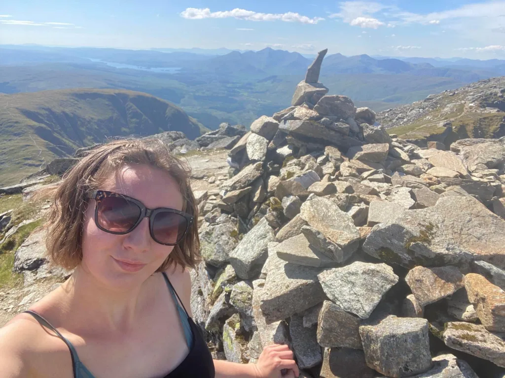
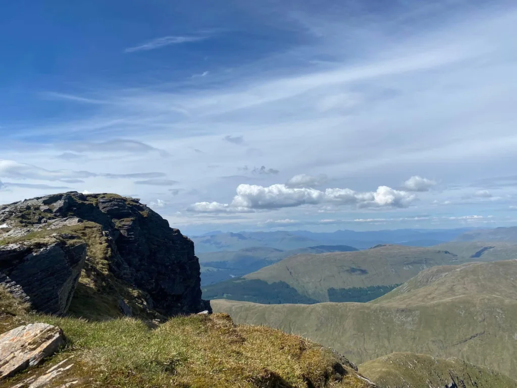
At the peak of Ben Lui, the summit is extremely narrow and rocky. From the summit of Ben Lui there are lovely views across the Tyndrum Munros – Ben Oss, Beinn Dubhchraig and Beinn a’Chlèibh.
In the distance I recognised the Crianlarich Munros and Arrochar Alps. From the peak of Ben Lui the route descends west and you can see the peak of Beinn a’Chlèibh.
This is a lovely climb to the peak which is a lot rounder than Ben Lui. Once you arrive at Beinn a’Chlèibh you can witness undisturbed views of Ben Cruachan, the west coast and Western Isles.
Descent
Walk back the way you came for almost a kilometre then turn left to descend into the corrie. Walk through the centre of the basin for almost a kilometre to reach the gate to the forest again.
Follow the same route from here to get back to the car park.
What to wear for this hike?
For hiking, I would wear comfy cosy clothes. It is best to wear t-shirts, jumpers, legging or trousers.
Also, it is best to pack many layers as the weather might change dramatically. In addition, it is important to pack waterproofs.
Hiking boots are suitable footwear to wear on this hike. Make sure to bring extra pairs of socks as this is a muddy route. It is important to be prepared to
What to pack?
It is useful to bring walking poles for this hike. Not only are walking poles good for helping take the pressure off your knees, it also help test out the mud ahead you.
Pack plenty of food and fluids for this hike. The closest place for facilities is in Tyndrum.
I would suggest to pack plenty of layers, sunscreen, sunglasses, midge spray, gloves and a hat. It is important to wear suitable clothing when hiking in Scotland.
How long does it take to climb Ben Lui?
The length of time that it takes to complete Ben Lui depends on the weather forecast, an individual’s fitness and the underfoot. It will take approximately 4 hours to get to Ben Lui and back to the car park.
Overall, the whole route took 5 hours and 15 minutes when I completed Ben Lui and Beinn a’Chlèibh in the summer of 2022.
Which route is best for Ben Lui?
The best route to complete Ben Lui is to start from the car park on the Old Military Road. Ben Lui can be reached in less than three hours from the car park depending on a person’s fitness and the weather conditions.
What does Ben Lui mean?
Ben Lui is also known as Beinn Laoigh in Scottish Gaelic. This translates to english as ‘calf mountain’
Final Note
This post lists a lot of useful information for hiking Ben Lui and Beinn a’Chlèibh. Ben Lui and Beinn a’Chlèibh are two Munros located in the Tyndrum Munros.
From the summit there are brilliant views across Loch Lomond and the Trossachs, Ben Cruachan and the Western Isles and as far as Glen Coe.
I climbed Ben Lui in the summer of 2022, it was a great at the top as the crags sheltered you from the wind. The weather was lovely, clear blue skies, it was great to relax on the peak of the Munro.
There are many Munros to bag near Glasgow and in Loch Lomond National Park. Also, there are a lot of Munros to bag near Fort William, Ullapool and Oban.
The best time to climb Munros in Scotland is in the summer months, between May to September. In the autumn, winter and spring there are a higher chance of poor visibility and weather.
This route is considered challenging and you are likely to meet other people on the way. I used the following websites to help plan my hike.
