Kintyre Way: The Ultimate Guide To The Long Distance Route
The Kintyre Way is a long-distance walking route in Argyll and Bute. It is a 100-mile route which was launched in 2006.
The route begins in Tarbert at the north end of the peninsula and ends at Southend. The Kintyre Peninsula has plenty of hidden coves, empty sandy beaches, small villages and gently rolling hills.
The Kintyre Way will take 4-7 days to complete. Also, the route is split into seven graded and waymarked sections which offer various walking terrain, from serious hiking to gentle rambles.
Supplies
Tarbet: Co-op Tarbet,
Clachan: Clachan Filling Station
Tayinloan: Tayinloan Stores
Campbeltown: Co-op Campbeltown, The Kintyre Larder, The Original Factory Shop, A Mckellar, Tesco Superstore
Southend: Muneroy Stores & Tea Rooms, The Argyll Arms
Accommodation
Tarbert: B&B, hotels – The Barge Tarbert, Knap Guest House
Clachan: B&B – Kirkland House B&B
Carradale: B&B, Hotels, campsite – Ashbank Hotel
Campbeltown: B&B, Hotels, Roy Place Apartment, Ardshiel Hotel
Southend: B&B, Hotels, campsite – Osborne Cottage
Machrihanish: B&B, campsite – Machrihanish Holiday Park
Public Transport
From Glasgow, there are regular CityLink buses. The CityLink buses stop at four main points on the trail: Tarbet, Clachan, Tayinloan and Campbeltown.
West Coast Motors is a local service which serves Claonaig, Carradale and Machrinhanish.
Plane: Flybe operates a twice daily service to Campbeltown from Monday to Friday.
Boat: Trips are available from Ardrossan to Campbeltown with three sailings a week in the summer.
Tarbert to Claonaig
- Distance: 17.7 kilometres (11 miles)
- Time: 5-8 hours
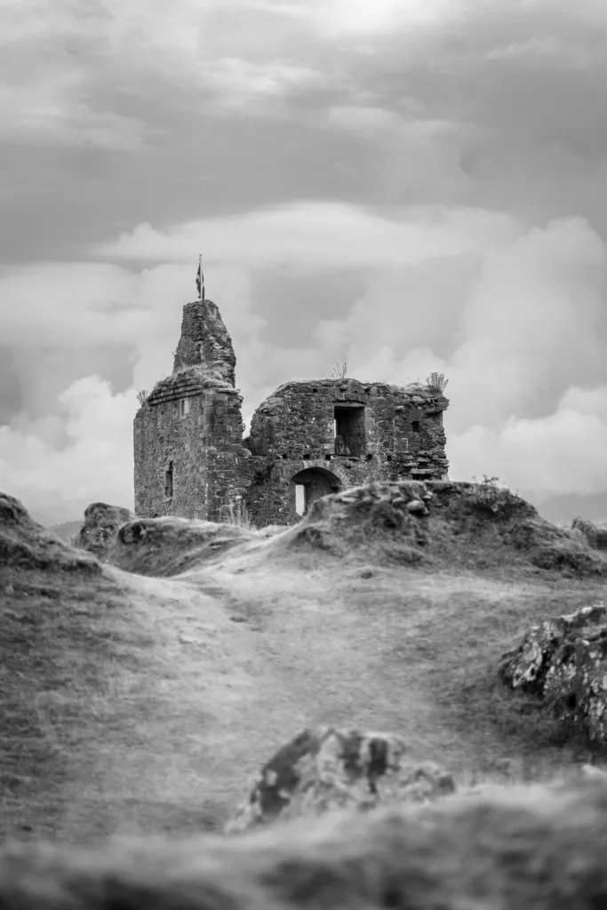
The first initial section of the Kintyre Way starts at the northern tip of the Kintyre Peninsula. This section cuts through the northwest part of the peninsula which ends at Claonaig.
Tarbett is a small fishing town and hosts one of the most magnificent harbours in Scotland. The town has been in existence since Norse times, it is believed by Robert the Bruce and James IV of Scotland.
In Tarbert, there is a selection of shops, a supermarket, a bank and a cash machine. For the start of the route, head northeast and follow the signs and steps to the 13th century Tarbert Castle.
At this part of the walk, are excellent views of the castle and moorland. Further on in this section of the walk, there are pretty views of Loch Fyne and walkers will pass the Tarbet Millennium Cairn.
The road at this point begins to climb and faces the south direction. Ahead you can see the rugged skyline of the Isle of Arran.
Soon you will see on either side of the track ruined stone buildings which are the remains of Glenskible. The path then follows the tree-lined Skipness River through the wooded glen.
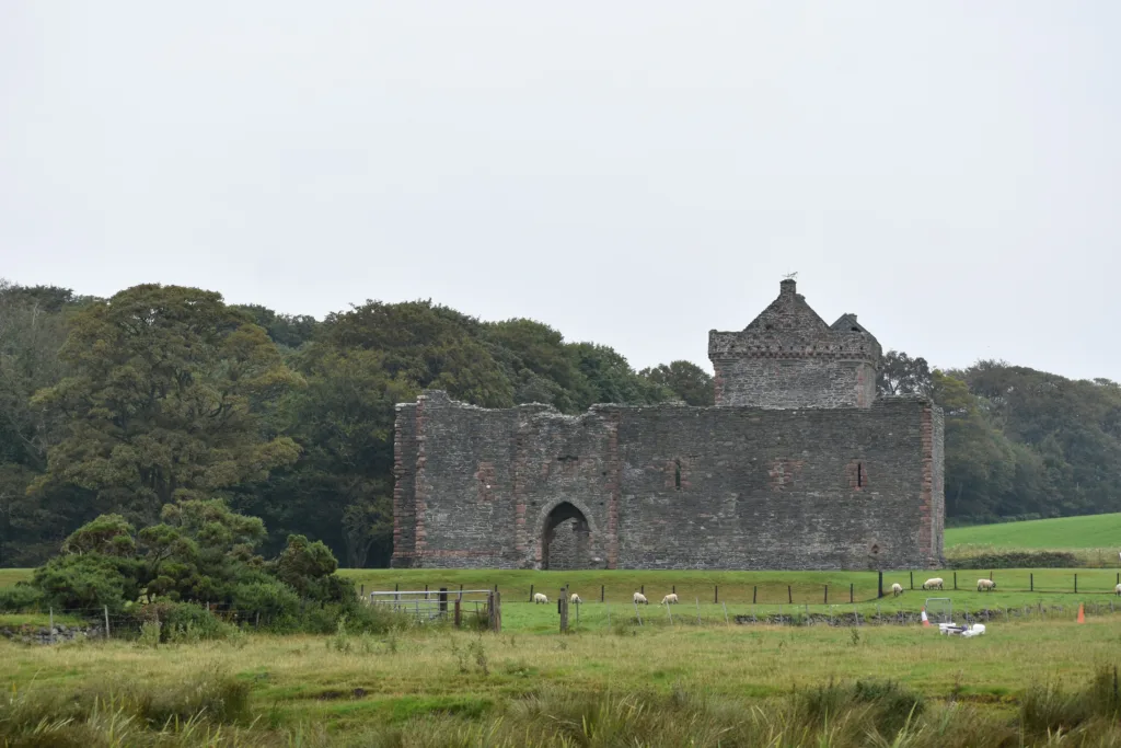
A slight detour at this point will lead you to Skipness Castle. To get there walk past St Brendan’s Church, cross the bridge and through the gateway on the right at the car park.
Kilbrannan Chapel can be reached by following the path through the eastern fence on the Skipness Castle grounds. There is a kissing gate to walk through before following the path along the shore to the chapel.
To get to Claonaig follow the B8001 road southwest to the Lochranza ferry terminal for the Isle of Arran.
Highlights (Tarbet to Claonaig)
- Tarbert Castle
- Tarbert Millennium Cairn
- Glenskible
- Skipness Castle
- St Brendan’s Church
- Kilbrannan Chapel
Claonaig to Clachan
- Distance: 16 kilometres (10 miles)
- Time: 5-7 hours
The second section starts in Claonaig and crosses from east to west across the Kintyre Peninsula and finishes in Clachan on the A83.
Claonaig is a small village located one mile south of Skipness. You can get the ferry to the Isle of Arran from here.
This part of the route heads southwest along the B842 single-track road. At the car park, turn right, the route heads uphill, and the Isle of Arran is in view.
The route rises gently, crosses Larchmore Burn and heads southwest through the moorland with heather and bilberry. Soon the route passes Loch Ciaran and Loch Ciaran Standing Stone.
The path will take you through the woodland and head downhill. Follow the A83 to the village of Clachan.
Highlights (Claonaig to Clachan)
- Loch Ciaran
Clachan to Tayinloan
- Distance: 14.4 kilometres (9 miles)
- Time: 5-7 hours
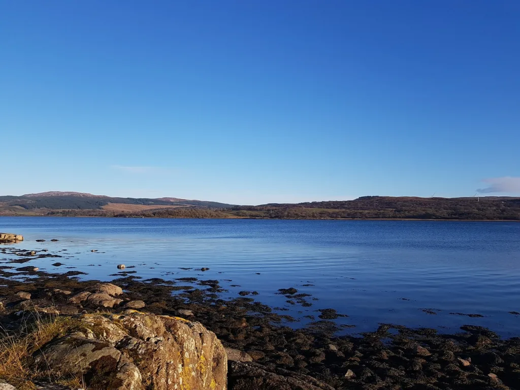
The third section of the Kintyre Way takes you along the west coast of the Kintyre Peninsula. Along this route walkers are the closest to the Isle of Gigha and can admire lovely views of the coast.
In Clachan, there is an old church which is surrounded by carved stone statues of the Chiefs of the Clan Alasdair. As the path climbs, there are excellent views of the West Loch Tarbert and the Paps of Jura.
The Isle of Gigha is viewable once you are about a mile away from Clachan. Follow the path to Ronachan House, this involves crossing two bridges.
At one point you will reach the Seal Point car park, and the Kintyre Way runs parallel to the shore. Along this part of the route, you will find the Correchrevie Burial Cairn, the largest of its kind in Kintyre.
Soon the route bears right and follows through the woodland. There is a small timber shelter and picnic table. The way marker posts indicate which way to go, you should eventually follow over Ballochroy Burn.
The track begins to decline downwards and leads to an open shingle beach. You should pass a closed fish farm, a brick-built World War II lookout and a holiday park.
Continue along the coast and shortly walkers will come across the ferry terminal for Gigha and the Ferry Farm is in view. Kintyre Way information boards are available and you have to follow the road half a mile inland to a T-junction to get to Tayinloan.
Highlights (Clachan to Tayinloan)
- Ronachan House
- Correchrevie Burial Cairn
Tayinloan to Carradale
- Distance: 25.7 kilometres (16 miles)
- Time: 6-9 hours
The fourth section of the Kintyre Way takes you from the west coast to the east coast of the Kintyre Peninsula.
The beginning of the route follows A83, walk past the beech hedge, shrouded Killean Burn. From near Kilmory, there are views of the Isles of Jura, Islay, Gigha and Cara.
The road past Kilmory leads into open moorland and leads past the ruins of Braid Farm. Just near the cattle grid, there is a shallow cup, which dates back to 4,000 years ago.
The shallow cup is covered with yellow lichen and are three inches in diameter. There are quite a few of these enigma features in Kintyre.
Follow up the forestry tracks and continue into Loch na Naich designated area. The path begins to climb again, you will walk past Drochaid Burn and one of the turbines.
The peak of Ben Cruachan, ‘the sacred mountain of Argyll’ can be seen to the north east. Soon, the path begins to descend again into the glen of Carradale Water.
Carradale
The village of Carradale will soon begin to appear. A small detour can be taken to visit Brackley Cemetery and chambered cairn.
The cemetery has mainly 19th and 20th century headstones. There is a chambered cairn in the field nearby, which is approximately 3,000 years old.
From the Grianain Picnic area, there are grand views across the Kilbrannan Sound and the Isle of Arran. Follow the course of Allt na Callich, down the forest track to Carradale.
Carradale is located at the head of Carradale Bay. The name reflects Norse origins meaning ‘brush-wood valley’.
Carradale is a village on the east side of Kintyre, there are brilliant views across the Kilbrannan Sound, the Isle of Arran and Firth of Clyde. This part of the route takes you across the peninsula from west to east.
Near Carradale is Carrdale House. This is where Naomi Mitchison (1897) – (1999), a leading 20th-century Scottish writer, lived there for more than 50 years.
Highlights (Tayinloan to Carradale)
- Brackley Cemetery
- Grianain Picnic Area
- Carradale Bay
- Carradale House
Carradale to Campbeltown
- Distance: 35.4 kilometres (22 miles)
- Time: 7-10 hours
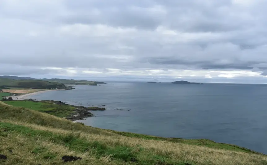
The fifth section of the Kintyre Way starts in the east coast of the peninsula before heading south down the centre of the peninsula. The finishing point for the fifth section is in the settlement of Campbeltown on the east coast of the Kintyre Peninsula.
Carradale is a village located on the east side of Kintyre. From Carradale, there are lovely views across the Kilbrannan Sound, the Isle of Arran and the Firth of Clyde.
Campbeltown is a settlement which is located on the Campbeltown Loch. The area is well known for the production of malt whiskey.
Previously, the town was called Kinlochkilkerran. In the 17th century, the name was after Archibald Campbell as he was granted the site.
Walk in the direction of the caravan park and follow the signs for Sally’s Walk. Head in the direction of Waterfoot and to Carradale Bay.
Waterfoot
There is a higher path alternative if the tide is high at Carradale Bay. The route goes past Torrisdale Castle and onto the ‘Gintyre Way’.
The ‘Gintyre Way’ is a reference to the Beinn an Tuirc distillery which is located further up the route. Follow the paths and cross the footbridges then up into the moorland and a forest track.
You can take a short detour to see Saddell Abbey and Ifferdale Farm and bunkhouse. Along this part of the route you can walk through Saddell Glen to Saddell village where you can see the Antony Gormley Grip Statue.
The route descends down to the derelict Bord a Dubh cottage. There is a small grove of trees nearby is ‘Hughie’s Wood’, a memorial to Hugh Macmillan (1927-1990) who was brought up in the cottage.
Kintyre Way crosses Strathduise Water which is at the northern end of Loch Lussa. Loch Lussa is a popular place for trout fishing.
The route heads south down a valley, climbs to a high point past Caliburn Quarry and Machrihanish comes into view. The last part of the section of the route descends into Campbeltown.
Highlights (Carradale to Campbeltown)
- Carradale Bay
- Torrisdale Castle
Campbeltown to Southend
- Distance: 25.7 kilometres (16 miles)
- Time: 7-9 hours
Southend is the main town on the southern end of the Kintyre Peninsula in Argyll. Interestingly, this part of the land is one of the closest to Ireland with only 13 miles between both countries.
This part of the route takes you around the south east corner of the Kintyre Peninsula. Christianity was first brought to Scotland from Ireland at ‘St Columba’s Footsteps’.
This part of the route begins at the Old Quay, past the ferry terminal, to Davaar’s Causeway. The route follows round the shore of Kildalloig Bay.
This part of Kintyre Way descends into the Balnabraid Glen and Corphin Bridge. The route rises again then drops into Glen Hervie. There are mile markers with distances from Campbeltown to Polliwillien and Southend.
Kintyre Way markers indicate the route across fields, past static caravans and down to a beach. In high tide, there is an alternate two mile route which leads back to the Kintyre Bay.
The route leads you to the Duke of Argyll memorial cross monument. This monument was erected in 1900 by the Duchess of Argyll in memory of the 8th Duke of Argyll (1823-1900).
Highlights (Campbeltown to Southend)
- Kildalloig Bay
- Kildalloig House
Southend to Machrihanish
- Distance: 25.7 kilometres (16 miles)
- Time: 7-9 hours
Machrihanish is located a short distance away from the tip of Mull of Kintyre. Machrihanish Bay is the main beach which runs for three miles to Westport. This is a perfect location for surfing.
Walk out from Southend towards Dunarverty Bay. There is an information board which shows information from the infamous siege and massacre of 1647.
Later on in the route there is a cemetery which has old carved gravestones and remains of St Columbas Church. Next you will pass the access point for Keil and St Columba’s footprint.
St Columba’s is a Celtic saint who is believed to have made a footprint in AD563. A local stonemason carved the other in 1856.
There is a car park with picnic tables and there is an information board which displays local information. The Kintyre Way heads into Glen Breakerie.
The route passes derelict buildings and leads into the Largiebaan Wildlife Nature Reserve. Soon the route climbs Amid Hill along the moorland and the shoulder of Remuil Hill.
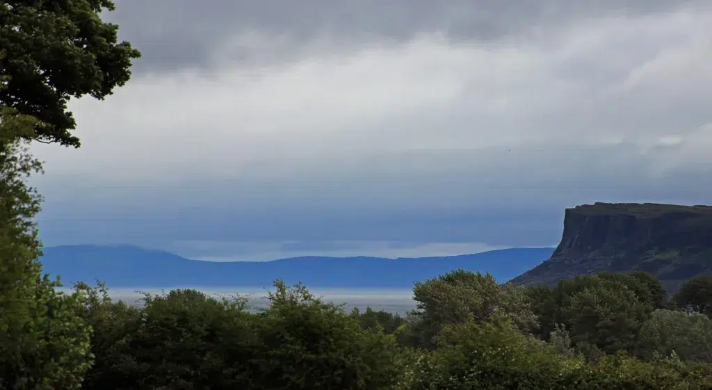
Along the track there are lovely views of Rathlin Island and Northern Ireland’s coast. The route ascends to the summit on Binnean, from here, there are great views of the Isles of Islay, Jura and Gigha.
The next part of the route heads up Innean Glen. The route descends to Craigaig Water and Machrihanish is only three miles away.
Machrihanish is a small village which overlooks Scart Isle and marks the end of the Kintyre Way.
Highlights (Southend to Machrihanish)
- Dunaverty Bay
- Keil and St Columba’s Footprint
- Lariebaan Wildlife Nature Reserve
How long does it take to walk the Kintyre Way?
The recommended time to complete the Kintyre Way walking is 7 days. The route is 100 miles long and parts of the route can be completed at a quicker pace with a bike.
Can you cycle the Kintyre Way?
There has been a few recent changes to the waymarked trails on the Kintyre Way so it is suitable for cyclists.
What does Kintyre mean?
Kintyre comes from the Scottish Gaelic phrase ‘ceann-tire’ which translates into English as ‘headland’.
Final Note
The Kintyre Way is a 100 mile long distance walking route in the Kintyre Peninsula. This route can be completed by foot or by bike.
The route begins in Tarbert and the trail zigzags through the Kintyre Peninsula. Most of the route was waymarked signposts and the route can be cycled.
On the east side of the peninsula there are gorgeous coastal views of the Firth of Clyde, Isle of Arran, Ailsa Craig and the Ayrshire Coast. On the west side of the peninsula there are great views to the Isle of Islay, Isle of Jura and Isle of Gigha.
On clear days the Northern Ireland coast and Rathlin Island can be seen from points of the route.
There is so much unexplored natural scenery awaiting to be explored in the southernmost part of the county of Argyll.
