Mayar and Driesh: Hiking Guide – Everything You Need To Know
Mayar and Driesh are two Munros that are located next to each another. These two Munros are a very popular combination to bag together and are pretty straightforward.
Mayar was the first Munro that I (accidentally) bagged. I went for a lovely summer walk to Corrie Fee, followed the crowd, and stumbled upon the summit.
From there once I realised I had climbed a whole Munro I decided to head to Driesh and bag number two. The weather was amazing that day and it would have been a waste of time if I had just headed home.
Mayar and Driesh are the most popular Munros near Dundee to bag. To the residents of Dundee and Angus, these are the best-known and most popular Munros to climb.
The Munros are much more rounded and less dramatic compared to others, however, it is still worth the climb.
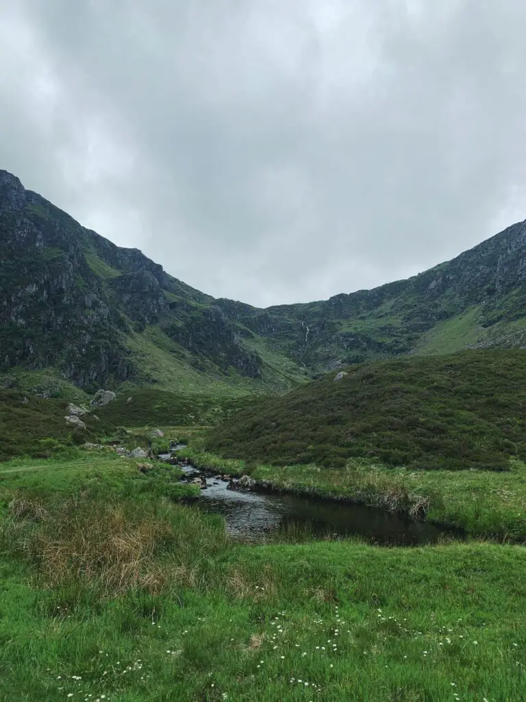
The route begins in Glen Clova Car Park and ascends through the stunning Corrie Fee National Nature Reserve. The summits of the two mountains are described as extensive rolling plateaus.
Mayar: 928 metres (3044 feet)
Driesh: 947 metres (3107 feet)
Distance: 14.5 kilometres (9 miles)
Ascent: 835 metres
Starting Point: Glen Doll Car Park
Where is this hike?
Mayar and Driesh are located in Glen Doll at the end of Glen Clova. Glen Doll is part of the Angus Glens.
The nearest small town is Kirriemuir. Kirriemuir is a 40-minute drive to Glen Doll Car Park.
This route is a popular climb for those who live in Angus and Dundee.
How long is the hike?
The hike is 14.5 kilometres long. The first three and a half kilometres from the car park takes you through Glen Doll Forest.
After that, one and a half kilometres the ascent through the bowl-shaped Corrie Fee Nature Reserve. From the waterfall, it is approximately one kilometre walk through the moorland.
Mayar and Driesh are three kilometres apart. From Driesh is approximately 5 kilometres back to the car park.
As a rough guide, I took 4 hours and 15 minutes to complete this walk. One hour was spent walking through Glendoll Forest and Corrie Fee. In the second hour, I reached the summit of Mayar.
From there it was an hour’s walk to get to the summit of Driesh. Then back down to the car park from Driesh took one hour.

Are the paths marked?
For the start of the route, there are clear paths from the car park to Corrie Fee. There are initially gently ascending forest tracks which open into a stunning glen.
There are clear steps and a small faint path up to the back of Corrie Fee. Once you complete the steep ascent at Corrie Fee the path starts to disappear into the moorland.
There is no direct path to the summit across the moorland. There are paths connecting Mayar to Driesh. Also, there is a mixture of paths from Driesh to the car park.
Is the trail suitable for beginners?
Mayar and Driesh is a popular couple of Munros to bag. This is a very popular route for beginners who want to want to move up to bagging two Munros in one go.
Little navigation is required as there are clear paths to the summits. There is no path to follow from the top of Corrie Fee to Mayar in the open moorland.
It is always good to be prepared, make sure to bring a map and compass to stay on track. Mayar and Driesh are two of my favourite mountains in Scotland to climb.

How to get to the Munro?
The best way to get to the Munros is to park at the Glen Doll Car Park and Ranger Base. There is no public transport to the starting point.
From Glen Doll Car Park and Ranger Base, there are a number of paths to the summits.
Route Description
The route description will describe the route for both Mayer & Driesh. First the ascent to Mayer, then the ascent to Driesh.
The two Munros are part of a circular route. I would head east first through Glen Doll and Corrie, then walk from Mayar to Driesh before heading back to the car park.
Ascent
For the ascent, you must first walk through the forest at Glen Doll. The Glen Doll car park is located at the head of Glen Clova and there is ranger information here.
There are great views of the Scorrie from the starting point. The Scorrie is the steep shoulder of Driesh that rises from the floor of the glen.
Follow the signs for the Forest Walks and take the track past the farm at Acharn, keeping left at the fork. After that, follow the signs for Corrie Fee.
Soon, on the right, Jocks Road (the ancient road to Braemar) leaves the right. Stay on the tracks and soon the path will take you across the White Water.
Soon the path becomes narrower and heads into the woods. The is a clear forest track which a gradual ascent.
During Storm Arwen in November 2021, plenty of trees had fallen over in this area. As of the summer of 2022, the situation was not resolved and there were a lot of trees to climb over. Hopefully, this is still not the case.
Once you have walked through the forest, the magnificent view of bowl shape Corrie Fee will open up. When I first saw this glen I was amazed!
The views are gorgeous and now Corrie Fee is one of my favourite walks to do. At the back of the glen, there is a fine waterfall.
Head up to the left side of the waterfall (SSW), climbing the rock-made stairs on the way. This is the steepest part of the walking route and the stairs make the route a little bit easier.
Once you have reached the top of the glen you will enter the open moorland.
Near The Summit
The ascent begins to level out in the kilometre of open moorland. There is not a clear distinct path when walking across the moorland, so beware during periods of bad weather.
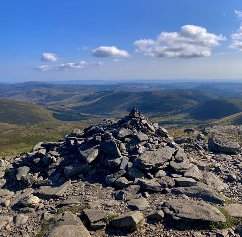
The summit of Mayar is marked by a small cairn. Soon you will reach the summit of Mayer where you will be rewarded with views of the Lowlands.
On a clear day, you can see Driesh and as far out as Forfar in Angus. To get to Driesh head northeast and follow the occasional fenceposts eastwards.
Once you have soaked in the views you can descend over 100 metres before climbing back up towards Driesh. The Kilbo Path is to the left and is marked by a tall post.
The descent follows the Kilbo Path and down the Shank of Drumwhallo into Glen Prosen. Driesh is marked by a trig point and massive shelter cairn.
From the summit of Driesh, there are similar views. You can see into Glen Doll on the way up.
Descent
The descent for me for fairly heavy on the knees. A set of walking poles may have helped.
The paths here are narrow and if you are walking with other people you will have to walk in a single file. Soon, you will be back into the forests.
You have to open the gate to get into the forest area and cross a few burns. The path gets wider and straighter on the way back to the car park.

What to wear for this hike?
The best thing to wear for this hike is comfy loose clothing. You will need a good sturdy pair of hiking shoes, either boots or trainers.
Wear t-shirts, jumpers, hoodies, thermals, leggings, shorts or anything you feel comfortable walking in. I would bring sunglasses, a hat, gloves, a scarf and spare socks just in case you get wet.
Also, I would wear a waterproof jacket or a windbreaker as you climb up and increase in altitude it will get colder. Follow this guide: What to Wear in Scotland for more guidance.
What to pack?
For hiking Mayar and Driesh I would pack plenty of snacks and lots of water. Make sure you have a good energy-packed meal before heading out so you do not get too tired.
In the winter, make sure you pack extra layers, a head torch, a hat, a scarf, gloves, waterproofs and gaiters. In the summer, make sure to bring midge repellent, sunscreen and shorts.
It might be useful to pack or bring walking poles to decrease the discomfort in your knees. Also, for navigating the Munros you should bring a map and compass.
Is Mayar and Driesh easy?
Mayar and Driesh is a moderate hike to complete. It is considered a good Munro for beginners and is usually the first Munros to get bagged for people who live in Dundee and Angus.
How long does it take to climb Mayar?
Climbing Mayar depends on the weather conditions and a person’s fitness level. Most people climb Mayar in 2 hours.
If you are walking through Corrie Fee, it takes one hour to get to the waterfall. Then from there, it takes approximately one hour to get to the trig point.
Where to park for Mayar and Driesh?
To bag Mayer and Driesh park at the Glen Doll Ranger Base Car Park. This car park fills up quickly in the summer months and at weekends.
Also, there is a car parking fee. In the summer there are tourist information and toilet facilities at the ranger base.
At the car park, there are picnic tables. Also, this is a main starting point for many walks in the area.
Is Mayar a Munro?
Mayar is a Munro located on the east side of Scotland. It is one of the most southern Munros in the Cairngorms National Park.
The height of Mayar is 928 metres. Munros are mountains in Scotland which are over 914 metres.
Final Note
Mayar and Driesh are located in the Angus Glens, north of Forfar and Kirriemuir. This pair of Munros is a great Munro bagging combination which features two rolling hills with fine paths.
It is unlikely that there is a phone signal in the rural areas near Glen Doll. So, make sure to plan ahead, let people know where you are going and download What3Words on your phone.
Mayar and Driesh feature fine paths and it is perfect for an afternoon walk.
