37 Great Munros Near Inverness Within An Hour’s Drive
There are so many great Munros near Inverness to hike. Many Munros are more accessible from Inverness compared to any other city in Scotland.
The city is a prime location to base yourself for tackling your next Munro. A Munro is a mountain in Scotland which is over 3,000 feet tall or 914 metres.
There are 282 Munros in Scotland. Munros are named after Sir Hugh Munro who collated a list of the mountains in the Scottish Mountaineering Journal back in 1891.
You are spoilt for choice when it comes to choosing what Munro to bag next. The closest Munro is only a forty-minute drive away.
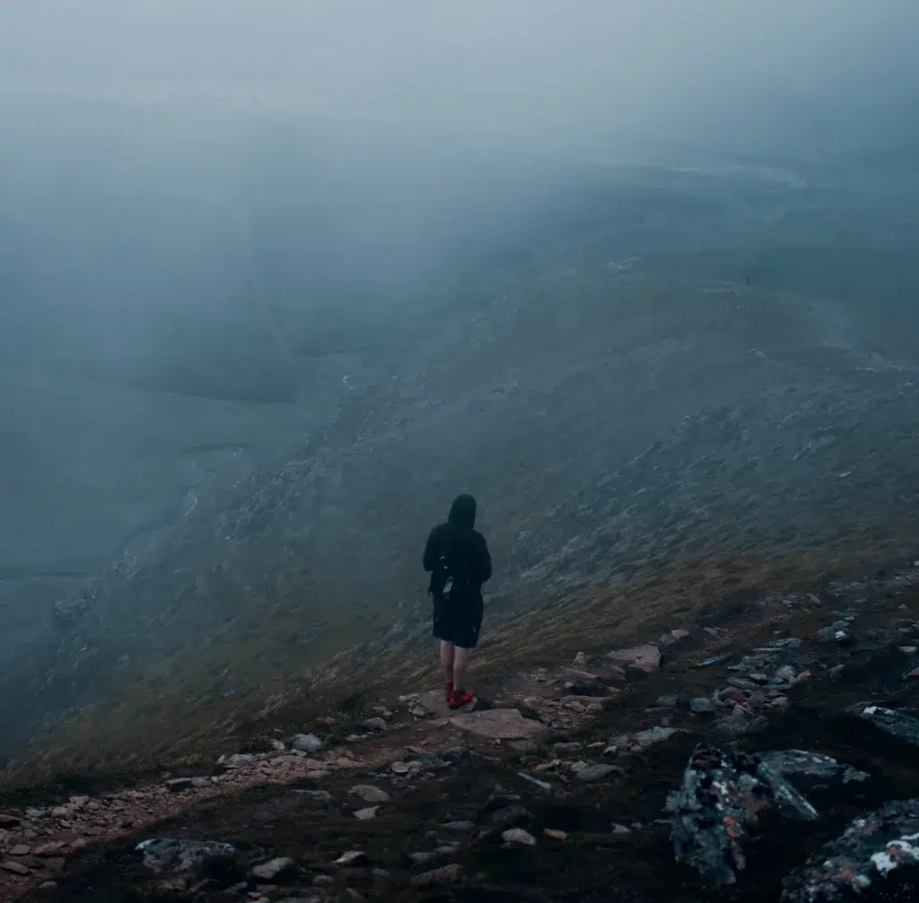
Ben Wyvis
- Height: 1046 metres
- Driving Time: 41 minutes
- Starting Point: Ben Wyvis Car Park
- Nearby Accommodation: Highland Hideaway
Ben Wyvis (Beinn Uais) is the closest Munro to Inverness. This isolated Munro is popular for its whaleback ridge, Ben Wyvis is 1046 metres high.
The route ascents up to the An Cabar and through the Nature Reserve, with a dramatic view down steep slopes to the south. The Munro takes up to six hours to complete.
From the summit are views of the Cairngorms, the Fannichs and the Moray Firth. A small car parking area fills up quickly on busy days. If the car park is full, a layby 1.2 mile up the road fits a few more cars.
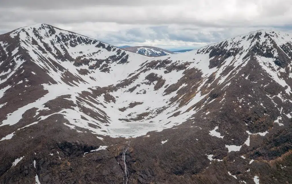
Braeriach
- Height: 1296 metres
- Driving Time: 48 minutes
- Starting Point: Whitewell
- Nearby Accommodation: Coylumbridge Cottage
Braeriach is the third-highest mountain in Britain and is the finest mountain in the Cairngorms. This Munro is 1296 metres high.
Also, Braeriach is high and remote, with amazing views across one of Europe’s most wilderness areas. This is one of the tougher Munros to tackle due to its remoteness.
On the ascent, the route passes Lairig Ghru and Loch Deo. From the summit, there are brilliant views down the Lairig and across Coire Brochan and the vast Garbh Choire to the peaks of Cairn Toul and Sgòr an Lochan Uaine.
There is parking at Whitewell, and the circuit from Whitewell takes eight hours. For longer routes, Braeriach can be climbed with Cairn Toul and Ben Macdui.
There are bothies to stay in on the route – Corrour and Garbh Coire Huts.
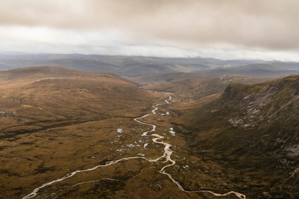
Cairn Toul, Sgòr an Lochain Uaine, The Devils Point
- Cairn Toul: 1291 metres
- Sgòr an Lochain Uaine: 1258 metres
- The Devils Point: 1004 metres
- Driving Time: 54 minutes
- Starting Point: Sugar Bowl Car Park
- Nearby Accommodation: Pine Marten Bat Glenmore Pods
This route is the most rewarding Munros to hike. As mentioned above Briaeriach can be climbed with Cairn Toul, Sgòr an Lochain Uaine and The Devils Point.
This route is an epic day of climbing for those that are extremely fit. Alternatively, the route can be split over two days and hikers can wild camp in the bothies.
Sgòr an Lochain Uaine is also known as Angel’s Peak, and it was promoted to Munro status in 1997. The original Scottish Gaelic name for Devil’s Point is Bod an Deamhain which translates to ‘penis of the demon’.
Devil’s Point is the first point to reach in the circuit and it is the most southerly of the Munros.
The first option to tackle these Munros is to park in the Sugar Bowl Car park, there is a car parking charge for this. Or, the Munros can be tackled by the Linn of Dee.
Fionn Bheinn
- Height: 933 metres
- Driving Time: 55 minutes
- Starting Point: Achnasheen
- Nearby Accommodation: Ledgowan Lodge Hotel
This may not be the most exciting Munro near Inverness. However, it does have an excellent view of many of Scotland’s best Munros in the peaks of Torridon with Beinn Eighe prominent.
Also, from the summit, there are excellent views north of the rest of the Fannichs and across Loch Fannich. The walk takes four hours to complete.
The easy climb begins at the small village of Achnasheen, where there is a car park.
There is a path which is used for the hydroelectric scheme, at the west of the village. The ground becomes boggy after a while and there is no clear path on the upper part of the hill.
Sgòr Gaoith
- Height: 1118 metres
- Driving Time: 56 minutes
- Starting Point: Invereshie & Inshriach National Nature Reserve
- Nearby Accommodation: Glenfeshie Hostel
This peak is one of the shorter walks in the Cairngorms National Park. Sgòr Gaoith is a fairly short walk from Glen Feshie.
Located on the western edge of the vast Cairngorm plateaux, standing between Glen Feshie and Glen Einich. From the summit, there are fantastic views across the Cairngorms and the dramatic drop to Loch Eanaich below.
The route takes five and a half hours to complete.
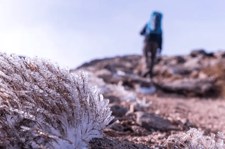
Bynack Mor, Cairn Gorm and Ben Macdui
- Bynack Mor: 1090 metres
- Cairn Gorm: 1245 metres
- Ben Macdui: 1309 metres
- Driving Time: 59 minutes
- Starting Point: Cairngorm Ski Centre
- Nearby Accommodation: Pine Marten Bar Glenmore Pods
Bynack More is a pyramidal peak and is a cornerstone of the high Cairngorms to the northeast. Cairn Gorm is one of the best-known summits in Scotland.
The ski development and the funicular railway mostly scar this peak. Ben Macdui is the second-highest mountain in Britain.
Mullach Clach A’Bhlàir
- Mullach Clach A’Bhlàir: 1019 metres
- Driving Time: 1 hour
- Starting Point: Glen Feshie car park
- Nearby Accommodation: Glenfeshie Hostel
The most popular ascent is from Glen Feshie car park. The ascent mostly follows a vehicle track but there are nice views down to Coire Garbhlach.
Nearby is the Ruigh Aiteachain bothy, which is handy for backpacking in the area.
Monadh Mòr and Beinn Bhrotain
- Monadh Mòr: 1113 metres
- Beinn Bhrotain: 1157 metres
- Driving Time: 1 hour
- Starting Point: Glen Feshie Car Park
Beinn Bhrotain is a round featureless slop which has heather covering the slopes and overlooks Glen Dee.
Starting from Glen Feshie is the longer route alternative for completing these Munros. The route is 29 kilometres long and takes 10 hours to complete.
Meall Chuaich
- Height: 951 metres
- Driving Time: 1 hour
- Starting Point: Lay by on A9, south of Cuaich
- Nearby Accommodation: Dalwhinnie Old School Hostel
Meall Chuaich is located near the small settlement called Dalwhinnie. The ascent follows a track which was made for the hydroelectric scheme.
Before heading up the featureless broad dome. This Munro takes five hours to complete, and the route is 14 kilometres long.

Carn Dearg, Carn Sgulain and A’chailleach
- Càrn Dearg: 945 metres
- Càrn Sgulain: 920 metres
- A’Chailleach: 930 metres
- Driving Time: 1 hour 2 minutes
- Starting Point: Newtonmore
- Nearby Accommodation: Fronthill
The start point is the end of a minor road up Glen Banchor, near Newtonmore. There is the possibility of bagging three out of the four Monadhliath Munros.
Càrn Dearg is the highest of the Monadhliath Munros. Also, it is the most easterly of the four Munros. This is a good circuit to complete and it can take eight hours.
Glen Strathfarrar Munros
- Sgùrr na Ruaidhe: 993 metres
- Càrn nan Gobhar: 992 metres
- Sgùrr a’ Choire Ghlais: 1083 metres
- Sgùrr Fhuar-thuill: 1049 metres
- Driving Time: 1 hour
- Starting Point: Glen Strathfarrar
- Nearby Accommodation: Craskie Glamping Pods
From the summit of Sgùrr na Ruaidhe and Càrn nan Gobhar there are excellent views east across Cromarty and Beauly Firths. Sgùrr a’ Choire Ghlais is the highest peak among the four Munros.
There is parking for this route just past Glen Strathfarrar road between Deanie Power Station and Loch a’Mhuillidh. To bag all four peaks, it will take nine hours for 25 kilometres of walking.
Moruisg
- Moruisg: 928 metres
- Driving Time: 1 hour 3 mins
- Starting Point: Layby on the south side of A890
- Nearby Accommodation: Carron View
Morusig rises above Glen Carron. Moruisg is often bagged with the Corbett, Sgùrr nan Ceannaichean.
Sgùrr nan Ceannaichean is 913 metres high, just missing out on Munro status. This sprawling peak can be completed as a circuit with the neighbouring Corbett and descending via the much more gentle ridgeback north.
Some parts of the route are boggy and quite steep. There is a small but followable path all the way to the summit. The route is 12 kilometres long and takes six hours to complete.

Meall a’Chrasgaidh, Sgùrr nan Clach Geala & Sgùrr nan Each
- Meall a’ Chrasgaidh: 934 metres
- Sgùrr nan Clach Geala: 1093 metres
- Sgùrr nan Each: 923 metres
- Driving Time: 1 hour 5 minutes
- Starting Point: Layby on A832, south-west of Braemore junction
- Nearby Accommodation: Clachan Farmhouse B&B
Meall a’Chrasgaidh, Sgùrr nan Clach Geala and Sgùrr nan Each are three Munros located along an excellent ridge.
Sgùrr nan Clach Geala is the highest peak out of the three Munros on this ridge. The route is 18 kilometres long and takes eight hours to complete.
Seana Bhràigh
- Seana Bhràigh: 926 metres
- Driving Time: 1 hour 6 minutes
- Starting Point Car park of Inver Lael bridge on A835
- Nearby Accommodation: Clachan Farmhouse B&B
Another great Munro peak is extremely remote in the wilderness. If you can take your bike and cycle through the first 5 kilometres of forest that will cut a large amount of time from your outing.
The route is one of the longest routes on this post, it is a total of 27 kilometres altogether.
Sgùrr Chòinnich and Sgùrr a’Chaorachain
- Sgùrr Chòinnich: 999 metres
- Sgùrr a’ Chaorachain: 1053 metres
- Driving Time: 1 hour 7 minutes
- Starting Point: Achnashellach Forest Car Park
- Nearby Accommodation: Carron View
Sgùrr Chòinnich and Sgùrr a’ Chaorachain are two Munros that are often bagged together. The ascent for both mountains involved walking through the glen of the Allt a’Chonais from the main Glen Carron.
The views from Sgùrr Chòinnich are awesome. Also, there is some good easy scrambling which made a very satisfying experience.
This route is 20 kilometres long and it takes between seven and eight hours to complete.
Tom a’ Chòinich & Toll Creagach
- Tom a’ Chòinich: 1112 metres
- Toll Creagach: 1054 metres
- Driving Time: 1 hour 8 minutes
- Starting Point: Chisholm Bridge
- Nearby Accommodation: Foxy’s Den
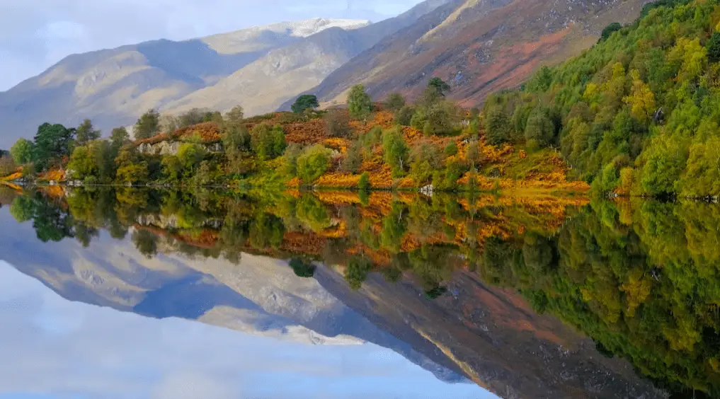
Tom a’ Chòinich & Toll Creagach is the easiest Munros to bag from Glen Affric. The two mountains contrast each another.
Toll Creagach is covered in moss and is a very rounded mountain. However, Tom a’ Chòinich is a more shapely peak with rocky ridges.
Tom a’ Chòinich is an eastward extension of the Carn Eige range. The starting point for this walk is in a car park which is located 200 metres east of Chishilme Bridge.
This 10-mile circular route takes approximately six hours to complete, depending on your fitness.
On the route, there are a few river crossings, where there are stepping stones to cross. Also, the paths are boggy in some areas but it is not too difficult to pass.
Càrn Eige and Màm Sodhail
- Càrn Eige: 1183 metres
- Màm Sodhail: 1181 metres
- Driving Time: 1 hour 8 minutes
- Starting Point: Chisholm Bridge
These two Munros are located in the Great Glen in Beauly, Scottish Highlands. Both Munros have spectacular viewpoints, however, they are super remote and tricky to get to.
The circular route takes 7 hours to complete. The route follows a horse-shoe ridge and can be made even more epic by adding the very remote Munro of Beinn Fhionnlaidh.
To start this walk, park in the car park which is located 200 metres east of Chisholm Bridge near the end of Loch Beinn a’Mheadhoin. The route commences on a path which takes you through a wood and past a hydro dam.
Two impressive Munros – Tom a’ Chòinich & Toll Creagach can be seen ahead. As you head up the glen the path becomes boggy. Soon on the route, Loch Mulladaroch comes into view.
Just after Stob Coire Dhomhnuill, there is a series of broken, jagged pinnacles which are impressive to look at. From the summit of Càrn Eige there are excellent views stretching from Skye to Ben Rinnes and Moray Firth.

Loch Mullardoch Munros
- Càrn nan Gobhar: 992 metres
- Sgùrr na Lapaich: 1150 metres
- An Riabhachan: 1129 metres
- An Socach: 1069 metres
- Driving Time: 1 hour 9 minutes
- Starting Point: Mullardoch Dam
- Nearby Accommodation: Craskie Glamping Pods
Càrn nan Gobhar rises high between Loch Mullardoch and Glen Strathfarrar. Càrn nan Gobhar is a fairly rounded peak and is a fairly rounded peak and is veiled by Sgùrr na Lapaich.
Sgùrr na Lapaich is the highest Munros of the huge and remote range of the mountains on the north side of Loch Mullardoch. From the summit, there are brilliant views of Kessnock Bridge and Inverness.
If you are wishing to bag all four Munros in one go, you are in for a long day. The starting and finishing point for this walk is at Mullardoch Dam, where there is limited parking.
An Riabhachan can also be tackled from the north, by walking through Glen Strathfarrar. Just to be aware that there are three Munros with the name An Socach, just so you get confused.
An Socach is the wilderness and is the most remote of the Mullardoch Munros.
Sgòrr Ruadh
- Height: 962 metres
- Driving Time: 1 hour 10 minutes
- Starting Point: Achnashellach Station
- Nearby Accommodation: Ledgowan Lodge Hotel
Sgòrr Ruadh is located in Strathcarron in the Highlands. Sgòrr Ruadh rises high above the Coullin Forest and Loch Coire Lair.
On the route, there are impressive views of dramatic pinnacles and a couple of other Corbetts. The route for Sgòrr Ruadh takes six hours to complete the 10-mile circuit.
What is the closest Munro to Inverness?
The closest Munro to Inverness is Ben Wyvis. Ben Wyvis is located northeast of Inverness.
It will take approximately 40 minutes to get there, thus being the easiest Munro near Inverness to reach.
What is the easiest Munro to climb in Scotland?
Ben Lomond is the easiest Munro to climb in Scotland. Ben Lomond is located in Loch Lomond and the Trossachs National Park.
Due to the close proximity of Ben Lomond due to the Central Belt, this peak is a big attraction for tourists and first-time Munro baggers.
Ben Lomond is the best Munro to bag as there is a clear path to the summit. From the top, there are lovely rewarding views across Loch Lomond.
Be aware, the ridge at the top of Ben Lomond is quite narrow in parts and not ideal for those who do not like heights.
Other good easy options include Ben Chonzie near Comrie and Mount Keen near Kirriemuir. Both these peaks have a clear wide path to the rounded summits.
How hard is Ben Wyvis?
It takes approximately 1 hour 45 minutes to hike to the top of Ben Wyvis, this depends on your fitness.
There are clear paths and steps to climb to get to the summit. Most ‘Munro Baggers’ describe Ben Wyvis as a nice easy pleasant walk compared to more serious Munros.
Final Note
This post lists the closest 37 Munros near Inverness. All of the Munros are within an hour and a 10-minute drive from Inverness.
Inverness is an ideal location to access many mountains in the Highlands of Scotland. The Highland capital is near Loch Ness, the Cairngorms, Torridon and the Ullapool hills.
There are plenty of Munros in the Highlands of Scotland. Read one of the guides for Munros near Fort William, Munros near Oban and Munros near Ullapool.
Also, there are many great mountains to hike across the whole of Scotland. There are plenty of Corbetts and Munros near Dundee, Perth, Aberdeen, Edinburgh and Glasgow.
Make sure you are prepared for heading out to the remote area of Scotland. Scotland is known for its immense weather, which can change rapidly, so it is best to be prepared.
Bring plenty of water, layer up, research the route and check the forecast.
Also, it is important to have snacks, a backpack, sun cream, and sturdy shoes. In addition, expect the temperature to drop as you get to the summit. Most summits in the Highlands are very exposed so bring warm clothing.
Some Munros near Inverness are accessible by public transport.
