15 Awesome Waterfalls Near Aberdeen
Scotland’s beautiful landscapes in the Highlands and Islands are not just limited to peaceful lochs and majestic Munros. It is great to visit waterfalls after a period of rainfall (which Scotland is well known for).
As you can see the powerful waterfalls are in full flow. There are plenty of these stunning waterfalls near Aberdeen as well as enjoyable nature walks.
Aberdeen is a prime location in Aberdeenshire as it is near the Highlands and the Cairngorms National Park. This post will describe some of the best well kept secret waterfalls in Aberdeenshire, the Muir Dinnet Nature Reserve and the Cairngorms National Park.
Also, this post lists some of the best waterfalls and nature walks that are a two-hour drive or less from Aberdeen.
Falls of Feugh
- Distance: 19 miles
- Drive Time: 40 minutes
- Starting Point: Bridge of Feugh Car Park
- Nearby Accommodation: Banchory Lodge
Falls of Feugh is located in the beautiful town of Banchory in Aberdeenshire. This waterfall is one of the closest waterfalls near Aberdeen.
This spot is even more magical in the autumn after some good rainfall. Also, there are facilities nearby including the Falls of Feugh Tearooms and public toilets.
The stone-built bridge is a brilliant spot to view salmon jumping up the river during spawning season. In addition, the Falls of Feugh is an easy quick spot to stretch your legs even if you are just driving through Banchory.
The bridge to view the falls is only a two minute walk from the car park. Also, the falls are a short walk from the centre of Banchory.
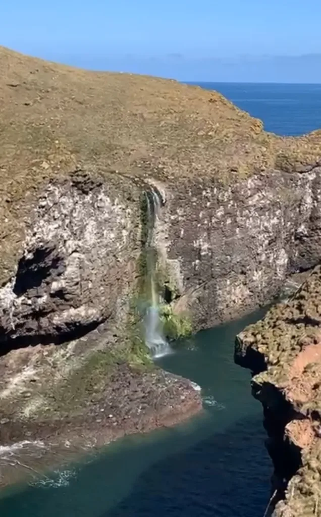
Crawton Waterfall, Stonehaven
- Distance: 21 miles
- Drive Time: 30 minutes
- Starting Point: Parking at RSPB Scotland Fowlsheugh
Crawton Waterfall is located at RSPB Fowlsheugh, near Stonehaven, where thousands of seabirds live. Crawton Waterfall is one of the waterfalls near Aberdeen which is located on the east coast.
The waterfall plummets over the cliff into the North Sea. After a period of high rainfall, the waterfall is immense.
There are several car parking spaces at the end of a narrow road. From the car parking spaces you can follow the paths to the gorgeous viewpoint of the falls.
It is the perfect destination for birdwatchers and photographers. Alternatively, you can complete a longer cliff-top walk from Stonehaven.
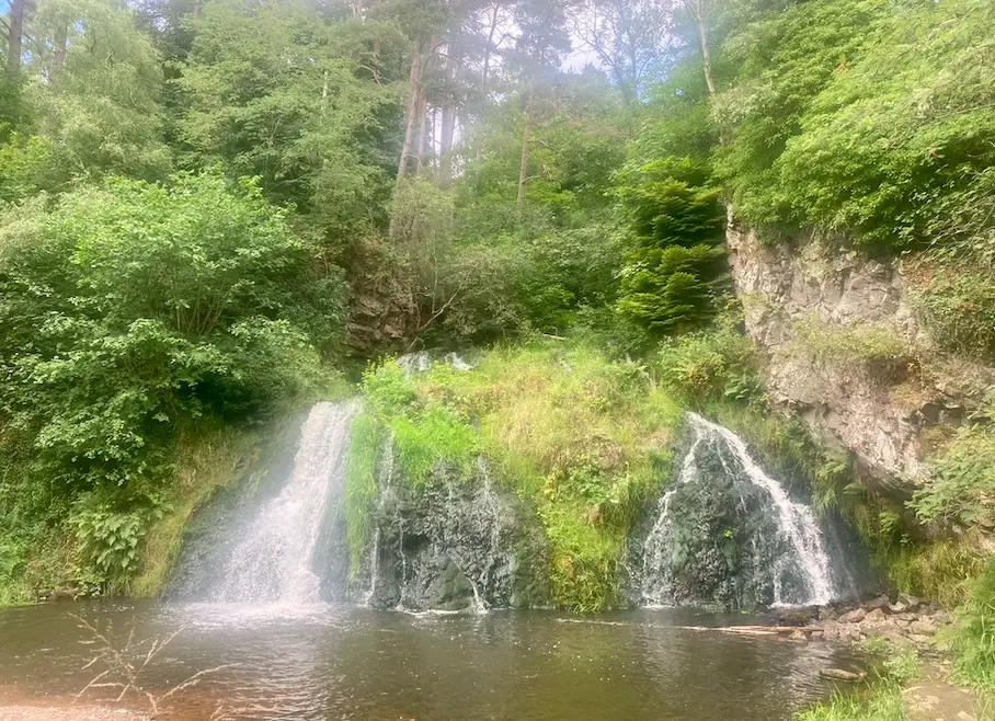
Dess Waterfall, Aboyne
- Distance: 30 miles
- Drive Time: 50 minutes
- Starting Point: Village Hall Car Park in Kincardine O’Neil
- Nearby Accommodation: Firhurst
Dess Waterfall is a great little waterfall located near Aboyne on the banks of River Dee. The falls are in a hidden spot south of Kincardine O’Neil, it is one of the brilliant waterfalls near Aberdeen.
It is very steep and strenuous to get down the gorge to the base of the waterfalls. However, the falls are beautiful, secluded and well worth the effort to get to.
There is a 4.8 mile circular walk from Kincardine O’Neil. The waterfalls are approximately half way through the walk.
If you decide to complete the circular walk you can park in the car park opposite the Old Smiddy onto the Deeside Way.

Den of Finella, Montrose
- Distance: 36 miles
- Drive Time: 45 minutes
- Starting Point: Off road parking on A92
Den of Finella is a stunning waterfall that runs under the A92. The waterfall is very difficult too and is not suitable for children or anyone who is unsteady on their feet.
There are ropes provided to get to the base of the falls. I would advise wearing old footwear as it is muddy.
Once you are there, it will feel like a tropical haven and it is hard to believe that you are in Scotland.
The location on Google Maps is called Den Finella Waterfall old Railway Bridge. Den of Finella is one of the most hidden waterfalls near Aberdeen.
To get to the falls you can park on the pavement of the bridge providing that there are no cars or a couple of cars already there. Make sure you do not block the road.
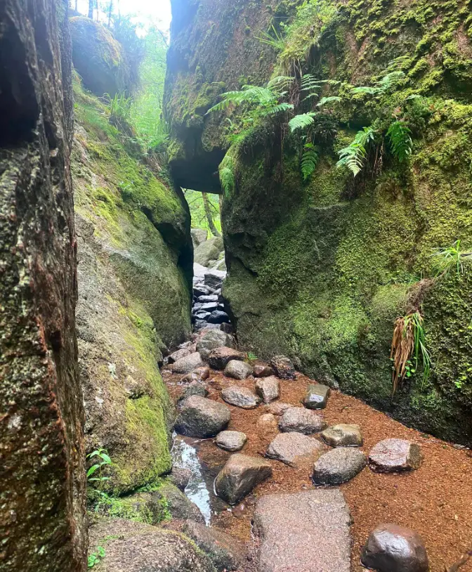
Burn O’Vat, Muir of Dinnet National Nature Reserve
- Distance: 37 miles
- Drive Time: 1 hour
- Starting Point: Muir of Dinnet Car Park
- Nearby Accommodation: Cairngorm Bothies
The Burn O’Vat is an impressive geological feature where you can enter a deep water-gouged bowl. The water-carved bowl was formed after the last ice age and can only be entered when the water is low.
There is a small flow of water which flows into the large stone cauldron. The ‘Vat’ has been a popular attraction since Victorian times and has a long history of being a hiding place for fugitives.
To get to the waterfall you can park in the Burn O’Vat car park on the Ballater to Aboyne Road. At the car park, there is a small visitor centre and toilet facilities.
Overall, the circular walk is four miles long and takes one hour and a half. Alternatively, you can walk to the Vat and back to the car which is a shorter walk.
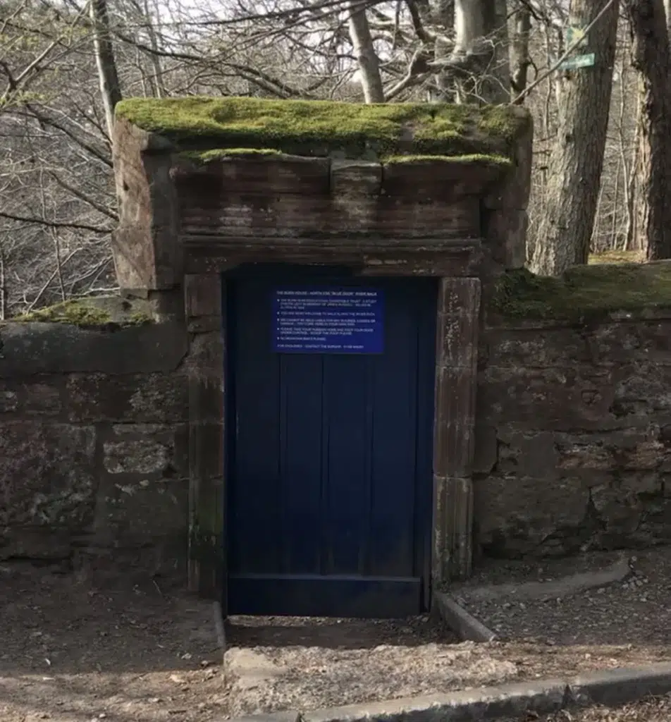
Rocks of Solitude
- Distance: 40 miles
- Drive Time: 50 minutes
- Starting Point: Lay by on B966
- Nearby Accommodation: Glenesk Hotel
The Rocks of Solitude is also part of the Blue Door Walk and is located on the River North Esk.
The walking route is located on the Angus and Aberdeenshire border near a small village called Edzell. If you want to feel like you are in wonderland then this is the place for you.
To get to the Rocks of Solitude you can park in a small layby near the river opposite the Glenesk Caravan Park. Also, if there are spaces you can park in front of the blue door on the B966.
Alternatively, when it is busy it may be best to park in the north end of Edzell and follow a longer circular route. The longer route is six and a half miles long and takes two and a half hours.
In addition, this is a popular walk for those who live closer to Dundee.
Linn of Muick
- Distance: 45 miles
- Drive Time: 1 hour 20 minutes
Linn of Muick is not very well known due to the lack of parking and signposts.
The waterfall is only a few miles from Ballater and next to a popular road to Loch Muick. The river collects water from the White Mounth plateau.
Linn of Muick is only just visible from the roadside. To get a better view you will have to climb through some grass.
Pirner’s Brig
- Distance: 46 miles
- Drive Time: 1 hour
Pirners Brig is located at the banks of the West Water near Edzell Castle. Also, the Brig has been a popular beauty spot for a long time.
After following the top of a shallow gorge, you will be able to descend, into wonderful rapids when the river is squeezed between massive boulders.
Falls of Glas Allt, Ballater
- Distance: 53 miles
- Drive time: 1 hour 35 minutes
- Starting Point: Parking area of Loch Muick Trails
The Falls of Glas Allt is a 50-metre waterfall near the head of Loch Muick, Aberdeenshire. The falls flow down from Lochnager.
Loch Muick is an upland, freshwater loch lying approximately 5 miles south of Braemar, Scotland. There is a circular route to follow which will take you around Loch Muick.
The overall distance is eight miles and should take three hours to complete. Also, there is a large car park at the end of the public road up Glen Muick.
In addition to the waterfall there is a lot to see in this area. The area used to be very popular with Queen Victoria and she used to stay in the mansion called Glas-allt-Shiel.
Also, this area is popular with hikers and there are a lot of Munros to bag. Munros include Carn a’Choire Bhoidheach, Carn an t-Sagairt Mor, Cairn Bannoch and Broad Cairn.

Falls of Unich and Falls of Damff
- Distance: 57 miles
- Drive Time: 1 hour 30 minutes
- Starting Point: Car Park
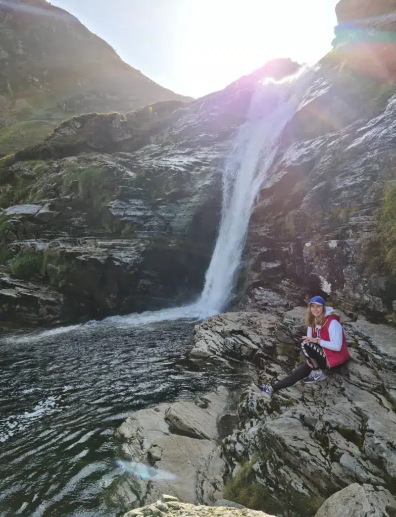
The Falls of Unich is a lovely walk along an easy path beside Loch Lee. This waterfall is perfect for photographers or bathers who like a dip in the cold water.
To begin the walk you can park at Invermark car park. Once you have passed Invermark Castle, the banks of Loch Lee, the waterfall should be viewable in twenty minutes or so.
Also, you can extend the walk a little further so you can visit the Falls of Damff. The circular walk from the Inversnaid car park is ten miles long and will take four to five hours.
Once you have viewed the Falls of Damff you will be rewarded with panoramic views over the loch.
Linn of Ruthrie Falls, Moray Speyside
- Distance: 60 miles
- Drive Time: 1 hour 30 minutes
- Starting Point: Car Park by the Spey, Aberlour
- Nearby Accommodation: The Cottage Aberlour
Linn of Ruthrie Falls is located near Aberlour, where the famous delicious Scottish shortbread is made. The short circular walk begins in Aberlour and finishes along the Aberlour Burn leading to the double-cascade Linn Falls.
The falls are not the largest waterfall you will see, however, they are still very impressive despite the smaller size. Also, if you are visiting the falls it is a great opportunity to walk the Speyside Way which runs through the town.
Linn of Dee, Braemar
- Distance: 63 miles
- Drive Time: 1 hour 50 minutes
- Starting Point: Linn of Dee Car Park
- Nearby Accommodation: Mar House
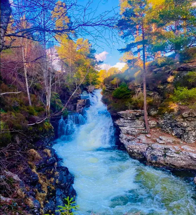
The Linn of Dee showcases some fine examples of the classic features of a Highland landscape. It is a totally magical place.
The River Dee has cut through granite rocks to form waterfalls, rapids and excellent paddling and swimming spots. The river’s cascades are topped by an old stone bridge.
There are marked paths which are low graded and signposted from the car park to the falls. There is a one hour circular walk known as the Linn of Dee circuit which takes one hour to complete.
In addition, the walk heads up to the lower reaches of Glen Luineg, passing more waterfalls and through stunning old pinewoods. The falls are a 30 minute walk from the car park to get to the falls.
The car park has a seasonal information hut and toilet facilities. Parking in the car park is £3 per day for non-members or free for National Trust for Scotland or National Trust members.
Linn of Quoich, Ballater
- Distance: 63 miles
- Drive Time: 1 hour 40 minutes
- Starting Point: Linn of Quoich car park
- Nearby Accommodation: Claybokie
The rushing waters of Quoich moving through narrow ravines creates a spectacular and unforgettable experience.
The Linn of Quoich is located in an idyllic setting in the highlands of the Cairngorms, Scotland. This hidden gem is a picturesque stopping point.
One of the best features of this walk is the Punchbowl. The Punchbowl is an astonishing, comma-shaped, water-carved hole in the otherwise flat rock formation.
According to the local legend, the Earl of Mar and his hunting parties would toast their success after a hunt by pouring spirits into the punchbowl.
Also, this location was one of Queen Victoria’s favourite spots. There is an old lodge built above the Linn which is now in poor repair.
Overall, the walk is three miles long and takes two hours to complete.
There is a car parking area on the left at the end of the public road towards the Linn of Quoich, 6km along the road from the Linn of Dee. The car parking costs £3.
Randolph’s Leap, Forres
- Distance: 84 miles
- Drive Time: 2 hours 20 minutes
- Starting Point: Logie Steading
- Nearby Accommodation: The Beeches
Randolph’s Leap is located on the River Findhorn and it is where the river is squeezed through a narrow ravine.
This scenic beauty spot is where Alexander Cummings and his four men leapt across the river during a clash with the Earl of Randolph in the 14th century.
The Earl of Randolph was the nephew of King Robert the Bruce and he owned the River. Therefore, that is how Randolph’s Leap has (wrongly) gotten its name, from when Cummings leapt over Randolph’s river when trying to escape.
Overall, the walk is two and a half miles long and takes one hour to complete. To begin the walk you can park in the car park which is located at Logie Steading visitor centre.
Also, there are shops and toilet facilities at the visitor centre. Alternatively, for a shorter route you can park in the small lay-by on the B9007, just south of the Bridge of Logie.
Dulsie Bridge & Gorge
- Distance: 93 miles
- Drive Time: 2 hour 20 minutes
- Starting Point: Lay by on south of bridge
Dulsie Bridge offers a rare glimpse over one of the most attractive parts of Findhorn River. This waterfall is one of the furthest away waterfalls near Aberdeen.
Also, it is a very picturesque tranquil area and is perfect for photographers. There is plenty of parking beyond the opposite side of the farm yard.
For those who are brave enough and knowledgeable enough to do it, you can jump from the old stone bridge into the dark pool below.
In addition, there are information boards showing how the river flooded over 100 years ago.
Final Note
This post has listed the most awesome waterfalls near Aberdeen. There are lots of waterfalls and scenic walks in the Highlands of Scotland.
More specifically, the Cairngorms National Park is a haven for nature lovers and has plenty of walks to enjoy which showcase the best waterfalls.
There are plenty of waterfalls all across Scotland, particularly in the Highlands. Explore waterfalls near Stirling, Edinburgh, Perth and Glasgow.
Head further afield to find waterfalls in Northern Ireland and Northumberland National Park.
